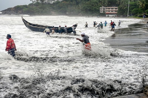
'Tauktae' likely to intensify into very severe cyclonic storm, cross Gujarat coast on May 18
The cyclonic storm "Tauktae" is likely to intensify into a very severe cyclonic storm and is very likely to move north-north-westwards and cross Gujarat coast between Porbandar and Naliya around afternoon or evening of May 18.

New Delhi: The cyclonic storm "Tauktae" is likely to intensify into a very severe cyclonic storm and is very likely to move north-north-westwards and cross Gujarat coast between Porbandar and Naliya around afternoon or evening of May 18.
According to National Weather Forecasting Centre of the India Meteorological Department, the cyclonic storm "Tauktae" (pronounced as Tau'Te) over east central and adjoining southeast Arabian Sea moved north-north-westwards with a speed of about 11 kmph and lay centred at 8.30 am today over east central and adjoining southeast Arabian Sea, about 190 km north-northwest of Aminidivi, 330 km south-southwest of Panjim-Goa, 930 km south-southeast of Veraval (Gujarat) and 1020 km south-southeast of Karachi (Pakistan).
"It is very likely to intensify further into a severe cyclonic storm during next six hours and into a very severe cyclonic storm during the subsequent 12 hours. It is very likely to move north-north-westwards and cross Gujarat coast between Porbandar and Naliy around May 18 afternoon / evening," it said.
Also Read |
Depression over Arabian Sea likely to intensify into cyclonic storm during next 12 hours: IMD
CS Tauktae lay centred at 1130 IST,15th May,over eastcentral Arabian Sea near latitude 13.2°N and longitude 72.5°E, about 290 km southwest of https://t.co/icXN7tD6u6 intensify further and cross Gujarat coast between Porbandar and Nalliya around 18th May afternoon/evening. pic.twitter.com/gffewNIhTI
— India Meteorological Department (@Indiametdept) May 15, 2021
According to an official release, IMD has predicted rainfall of varying intensity, from light and moderate to extremely heavy, due to the impact of cyclone in Lakshadweep Islands, Kerala, Tamil Nadu, Karnataka, Konkan and Goa, Gujarat and West Rajasthan. It said that gale wind speed reaching 75-85 kmph gusting to 95 kmph is prevailing over east-central Arabian Sea and adjoining southeast Arabian Sea and Lakshadweep area. It is likely to increase over east central Arabian Sea becoming 120-130 kmph gusting to 145 kmph from May 16 morning.
Sea condition over eastcentral Arabian Sea will be high to very high on May 15 and very high to phenomenal on May 16 and over northeast Arabian Sea on May 17 and May 18, IMD said. It said that tidal wave of about 2- 3 m above astronomical tide is likely to inundate coastal areas of Morbi, Kutch, Devbhoomi Dwarka and Jamnagar districts and 1-2 meters along Porbandar, Junagarh, Gir Somnath, Amreli, Bhavnagar and 0.5 to 1m over the remaining coastal districts of Gujarat.
Also Read |
All flights to and from Goa cancelled today: Goa airport officials
The IMD said there should be total suspension of fishing operations over eastcentral and adjoining southeast Arabian Sea and along and off Kerala, Karnataka, Goa, Maharashtra coasts. It also advised total suspension of fishing operations over northeast Arabian Sea and along and off Gujarat coast from May 17.
"The fishermen are advised not to venture into southeast Arabian Sea, Lakshadweep- Maldives areas, east central Arabian Sea along and off Karnataka coast, eastcentral Arabian Sea and along and off Maharashtra-Goa coasts and into eastcentral and adjoining northeast Arabian Sea along and off Gujarat coast till May 18," it said. Those who are out at sea over north Arabian Sea have been advised to return to the coast. (ANI)
 Dynamite News