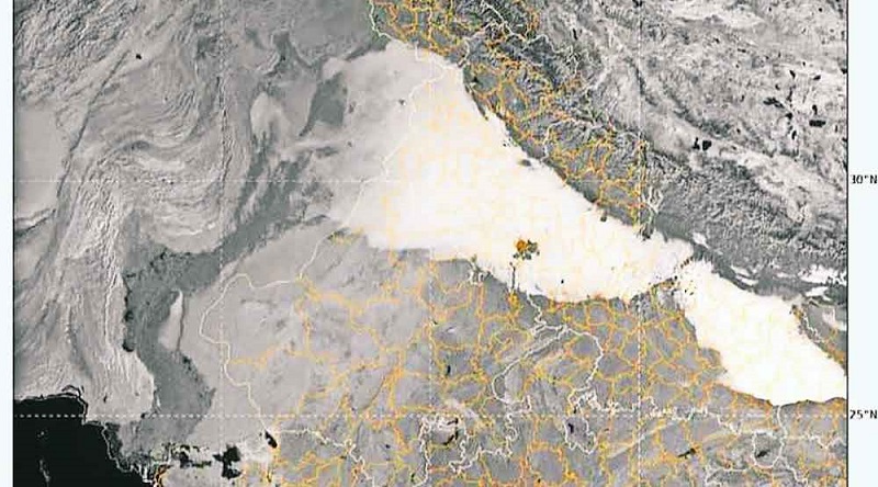
IMD Satellite imagery shows dense fog blanket over Northern India
An INSAT (Indian National Satellite System) imagery released by the Met department on Wednesday morning depicted fog hovering over the North India region. Read Further on Dynamite News

New Delhi: An INSAT (Indian National Satellite System) imagery released by the Met department on Wednesday morning depicted fog hovering over the North India region.
The satellite image taken at 11:30 am (IST), showed a fog layer continuing over Punjab, Haryana, West Uttar Pradesh and extreme parts of North Rajasthan.
Also Read |
Coastal Karnataka, Goa to receive heavy rainfall
According to the Met department, the minimum temperature recorded during past 24 hours over most parts of Punjab, Haryana, Chandigarh, Delhi, Madhya Pradesh and Rajasthan was in the range of seven to ten degree Celsius.
"Minimum temperatures realised during past 24 hours till 0830 IST today are in the range of 7-10°C over most parts of Punjab, Haryana, Chandigarh & Delhi, Uttar Pradesh, Madhya Pradesh and Rajasthan," India Meteorological department said in a post on X.
Also Read |
IMD predicts heavy rainfall over Vidarbha, Odisha
On wednesday morning, several regions of North India including Delhi, Uttar Pradesh, Punjab and Haryana were engulfed in a thick layer of fog, causing low visibility leading to traffic disruptions and accidents.
Due to fog"dense fog in the Agra national highway, Multiple vehicles collided due to low visibility causing injuries to many. Meanwhile, In the Bagpat district of Uttar Pradesh, two vehicles collided, in which several were injured.
 Dynamite News